More to follow...

(like this)
For a quick and dirty pictoral tour, you can go here. Full story is below...
I've been planning a leaf peeping tour of my own for a while, but weekends haven't been working out, and the weather looked like there was one more bit of warmth, so I opted to take Tuesday off and just go ride. The temps were supposed to be mid 70's, but in the early morning, it was barely 50 at my house, and my electric vest didn't work the last time I tried it.
I figured I'd check the easy stuff first, and pulled out the in-line fuse the vest has on the lead to the battery, and after looking at that, I don't know how it ever worked! Advanced Auto Parts hooked me up, I plugged in the fuse, and voila, the controller lit back up, once again. That all happened before 9 a.m.
By 9:03, I was rolling down the driveway to go fill my tires, which were both down about 6-8 pounds. Money from the ATM and I was rolling at 9:15 a.m.
The temperature did some weird fluctuating for the next few minutes, and got up to 60 by the time I was out of Travelers Rest, but within 10 minutes, it was down to 48 again, going across country roads. The 60 had me starting to sweat in my layers, and the 48 had me singing happy songs about my electric vest.
Even though I was being sneaky and riding on a Tuesday, I saw quite a few other bikes, the first of which was heading down 178 from Rosman, passing me while I was going north to Rosman. The waves I gave to every biker had an extra note of camaraderie...we weren't just weekend riders. We took vacation time to go ride in the week, heh heh.

Once out of Rosman and on to 64W, I was behind a couple of pickups for a few miles, but it wasn't very long before my turnoff to the magical 281, my very own hooligan road. The gravel was toned down in the first part, since the last time I'd ridden it in July, which was a relief. I finally started getting some pictures here. The color hadn't been spectacular to this point. It was either still pretty green, or naked branches...you pick.
I almost stopped at Wolf Creek Lake, but there were a lot of utility trucks there, so I just pul
 led off by the side and grabbed some shots. The sun overpowered some of the shadows, but it was still a nice view.
The rest of 281 is just too much fun to take pictures, and once that ended at 107, I found another road which was pretty intense, called Pine Creek Road, which changes to Walnut Creek Road before it drops off into Hwy 64/28. I think I would have rather come the other direction on that one, since all of the hairy hairpins and switchbacks would have been uphill. As it was, I felt like I was doing a handstand on the bars, looking down the road before me.
You weren't on that road unless you had some reason to be on that road (in my case, specific curiosity). You don't just 'stumble across' that one. I'll have to look it up again one of these days and traverse it west to east. Maybe take a picture next time, too.
At any rate, I was only five or six miles outside of Franklin at this point, where I picked up 28N out of town. This is t
 he route to go up to the Dragon, and a road I've taken a few times. On the route, I've seen this side road a few times that I've wondered about, called Tellico Road. Part of my goal from today's riding was to take that road less travelled, and loop around to Wayah Road, which internet investigation promised good riding.
 The scenery along Tellico Road was very nice. Curvy, peaceful, secluded...and then.
Then, I passed a road sign that said, "Pavement Ends," which it promptly did. It wasn't super bad, loose, rutted gravel
 , and I wasn't about to be turned away from my investigation, so I kept going. Shortly after, I came up a lane with a beautiful stone fence, very reminiscent of Kentucky.
The road turned, however, and nothing looked like Kentucky. It started looking more like I'd see a Gingerbread House with an old crone outside. The occasional sprinkling of 4x4 pickup trucks with hunting dog crates in the bed helped offset that impression, though. It weren't too near any civilization, though, I'll tell you that. (Peak leaf season, boo - scary forest...get it? Oh, nevermind.)

I had to pull over one time for an oncoming Chevy Tahoe to pass me, since the road was not a two lane avenue by any stretch of the imagination. The curves were often blind, and I approached most of them with healthy caution. After a certain point, I didn't see any more hunters (or utility workers with bright orange hats, as I originally though them to be), but the road kept going. So did I.

Occasionally, I pulled off for a few "you won't believe this!" pictures to show where in the world I was. The dirt road ran along much of what was a cut for power lines, so they
 got included in the shots.
The prettiest pictures of the day were from an overshadowed part of the road where I just had to stop and snap a couple. It's easy to get too
 wrapped up in the riding and skip the pics, so I tried to make conscious efforts to document this rather, erm, unusual part of my trip. (Remember, you can click on any picture to enlarge it.)
Again, see the ribbon of road below? I don't get turned back easily, even with switchb
 acks full of gravel and dirt :)
At the summit of the gap (Tellico Gap), there was a sign indicating that the Appalachian Trail crosses there. After reading some today, it turns out there is an old fire tower that was rebuilt for hikers to go up and enjoy the view, which is about 1.5 miles' worth of a hike from the top of the gap. I think I may need to go back up there and check it out one day with a good camera. The road won't be quite some daunting, since I at least know what to expect.
From the AT intersection, my gravel and dirt road started to angle down. I mainly used engine braking in first gear to keep my speeds reasonable, and the descent was nowhere near as long or sustained as the ascent on the other side of the mountain. Seemed like no time at all before I started seeing signs of civilization, and boom, there was asphalt on the road ahead of me! Yeah baby!
I knew I'd stayed on Tellico Road over the mountain, but I wasn't sure I was supposed to go that route, since the way I planned to go was going to change names at least once
 (pretty common in these parts). Even though I thought it might be off route, I was willing to figure it out, once I got somewhere recognizable.
 Happy times, though, because the next road sign showed that I was now on Otter Creek Road, which was my intended route to Wayah Road. My five mile dirt road trip over the mountain was NOT in vain!
Wayah Road was next, and the many reviews online about this stretch hit it pretty nicely. Good sweepers, beautiful views, some technical sections
 with hairpins, but not overtaxing. And no one in front of me for the entire 20+ miles. The road goes along the edge of Lake Nantahala, which was glass smooth, except for one boat ripple. There was a restaurant I meant to stop at, but missed, so I kept riding.
There was another section of the AT that crossed Wayah Road, and was 13 miles from Franklin. The next 13 miles were a series of skinny switchbacks. Skinny, because leaves had pooled at the edge of the lane, leaving the workable asphalt to less than the standard 8 feet. Nothing too hairy, though.
At the bottom of the road, it was a short hop to the right to get onto Highway 64, which had some of the prettiest scenery of the day. I rode on that until I hit an uphill stretch and could s
 ee two tractor trailers ahead of me that were pulling really slowly up the grade. Right then, there was a scenic overlook pulloff, and since I hadn't gotten off the bike in 4.5 hours at that point, I figured it would be a good time for a break.
It had warmed up to around 70 by now, so my quilted liner in my jacket and pants were a bit overkill, as was my form f
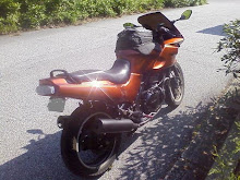
 itting vest (even with the power off). It was a welcome respite to stand and delayer. There were two other bikes at the overlook, and one of the riders came over to ask where I was heading from and going, and offered to take a picture of me with the bike (since all I could do was take a pic of the bike by his lonesome). I let him take the picture, figuring I had to look pretty rough, since I'd just taken my helmet off for the first time in over four hours. At least it was proof I was there, right?
Fifteen minutes later, I was back on 64, heading over the mountain and on down to Hiwassee, GA for a lunch break. It was also my fuel stop for the day, and I'd put 185 miles on the bike since I put my kickstand up in the morning. It was an hour to ride in to Hiwassee, and by then, I was ready for a real, sit-down break. Nothing especially noble for lunch, but my Zaxby's was good. I wrote a few things in my journal, and just savored sitting there, leaning back with my legs stretched.
About 30 minutes later, and I was back on the road, with 40 miles to go to Clayton, GA on
 Highway 76, which is one of the nicest motorcycle highways I've been on. It's got decent passing zones, so the 'pokes can move over, and gorgeous views as you go.
 Once in Clayton, I did a quick hook over by the BP station on 441 to get onto Warwoman Road which runs over to Highway 28. A fellow rider from my biker website told me about this road a couple of years back, and I run it every once in a while.
This day, however, the last few miles of it were polluted by a '95 Chevy Blazer that saw no need to be courteous and pull over. A couple of times I just stopped in the middle of the road to let him get ahead before I'd ride through the next few curves and catch back up. There wasn't anywhere I could pass with any idea of prudence, so I was stuck. When we got to 28, however, at least he let me pass him to get onto the road first.
Highway 28 is another beaut. This one keeps you on your toes, though, and the trees were spectacular. I wish I had a good helmet cam, so I cou
 ld just ride and not be clicking pictures to share all the time :) Once down to Walhalla, I turned east to head back to Greenville.
 By now, it was getting near quitting time for most office drones, so traffic started picking up. The last 30 or so miles were quite mundane, and I pulled into my driveway about five minutes later than any normal workday, so the Riley booger dog didn't have any longer to wait than normal.
Once I got home, he and I went for a nearly two mile walk, and it felt so good to be moving my legs. Even with the seat modified by Spencer on that bike, I wouldn't have wanted to ride much more. I figured my day at work on Wednesday would be a little painful, but there has been a surprising lack of soreness, which is good. My co-workers get annoyed when I groan.